Geolocate

Cortes topographic map

Click on the map to display elevation.

About this map

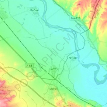
Name: Cortes topographic map, elevation, terrain.

Location: Cortes, Erribera / Ribera, Navarre, 31530, Spain (41.91307 -1.51790 41.96325 -1.38009)

Average elevation: 856 ft

Minimum elevation: 748 ft

Maximum elevation: 1,181 ft

Gear up for your next adventure:

🧣Merino Neck Gaiters - Multi-functional headwear for wind and sun protection
🔌USB Car Charger - Car charger for on‑the‑go power needs
🧭Pro Hiking Compasses - High-accuracy liquid-filled compasses for topographic orientation
🚁Photography Drones - Capture stunning aerial views of landforms and topography
📚Navigation Handbooks - Master the art of reading topographic maps and using a compass

As an Amazon Associate, this site earns from qualifying purchases at no extra cost to you.