
Wawaset Park topographic map
Interactive map
Click on the map to display elevation.
About this map
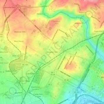
Name: Wawaset Park topographic map, elevation, terrain.
Average elevation: 157 ft
Minimum elevation: 0 ft
Maximum elevation: 308 ft
Other topographic maps
Click on a map to view its topography, its elevation and its terrain.
Landlith
United States > Delaware > New Castle County > Wilmington
Landlith, Wilmington, New Castle County, Delaware, 19802, United States
Average elevation: 46 ft
Rodney Square
United States > Delaware > New Castle County > Wilmington
Rodney Square, Rodney Square Historic District, Wilmington, New Castle County, Delaware, United States
Average elevation: 66 ft
Wilmington
United States > Delaware > New Castle County > Wilmington
Wilmington, New Castle County, Delaware, 19884, United States
Average elevation: 141 ft