
Thank you for supporting this site ❤️
Make a donation
Make a donation
Gear up for your next adventure:
As an Amazon Associate, this site earns from qualifying purchases at no extra cost to you.
Tortosendo topographic map
Click on the map to display elevation.
Thank you for supporting this site ❤️
Make a donation
Make a donation
Gear up for your next adventure:
As an Amazon Associate, this site earns from qualifying purchases at no extra cost to you.
About this map
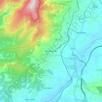
Name: Tortosendo topographic map, elevation, terrain.
Location: Tortosendo, Covilhã, Castelo Branco, 6200-789, Portugal (40.19975 -7.56321 40.27975 -7.48321)
Average elevation: 1,959 ft
Minimum elevation: 1,286 ft
Maximum elevation: 4,252 ft
Thank you for supporting this site ❤️
Make a donation
Make a donation
Gear up for your next adventure:
As an Amazon Associate, this site earns from qualifying purchases at no extra cost to you.