
Thank you for supporting this site ❤️
Make a donation
Make a donation
Gear up for your next adventure:
As an Amazon Associate, this site earns from qualifying purchases at no extra cost to you.
Oberlichtenau topographic map
Click on the map to display elevation.
Thank you for supporting this site ❤️
Make a donation
Make a donation
Gear up for your next adventure:
As an Amazon Associate, this site earns from qualifying purchases at no extra cost to you.
About this map
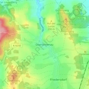
Name: Oberlichtenau topographic map, elevation, terrain.
Location: Oberlichtenau, Pulsnitz, Bautzen, Sachsen, 01896, Deutschland (51.19810 13.97357 51.23810 14.01357)
Average elevation: 883 ft
Minimum elevation: 712 ft
Maximum elevation: 1,168 ft
Thank you for supporting this site ❤️
Make a donation
Make a donation
Gear up for your next adventure:
As an Amazon Associate, this site earns from qualifying purchases at no extra cost to you.