Geolocate

Good Hope topographic map

Click on the map to display elevation.

About this map

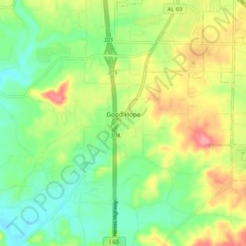
Name: Good Hope topographic map, elevation, terrain.

Location: Good Hope, Cullman County, Alabama, United States (34.08364 -86.89226 34.14388 -86.82762)

Average elevation: 689 ft

Minimum elevation: 561 ft

Maximum elevation: 873 ft

Cullman County trails, hiking, mountain biking, running and outdoor activities

Gear up for your next adventure:

🌐World Map Poster - Decorative world maps with topographic info
🛰️Handheld GPS Units - Professional satellite navigators for precise backcountry mapping
🛰️Satellite Messengers - Emergency SOS and two-way messaging for off-grid adventures
🦟Ultrasonic Repellers - Create a bug-free zone at your camp or rest stop
🧭Hiking Compass - Precision compass for reliable navigation in the wilderness

As an Amazon Associate, this site earns from qualifying purchases at no extra cost to you.