Geolocate

Changzhou topographic map

Click on the map to display elevation.

About this map

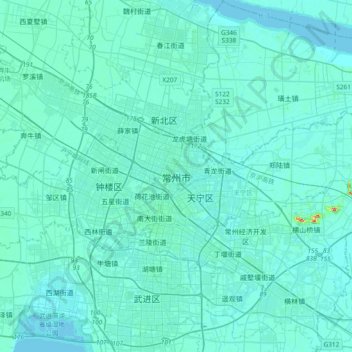
Name: Changzhou topographic map, elevation, terrain.

Location: Changzhou, Jiangsu, 213000, China (31.65226 119.80915 31.97226 120.12915)

Average elevation: 20 ft

Minimum elevation: -7 ft

Maximum elevation: 279 ft

Gear up for your next adventure:

🚁Photography Drones - Capture stunning aerial views of landforms and topography
🏔️Mountain Trail Maps - High‑detail maps for popular peaks
🧢Sun Protection Hats - Wide-brimmed and UPF-rated hats for high-altitude sun safety
Backpacking Tent - Lightweight and durable tent for multi‑day hikes
🚗GPS Dash Cams - Record your scenic drives through mountain passes and canyons

As an Amazon Associate, this site earns from qualifying purchases at no extra cost to you.