Geolocate

Caribe topographic map

Click on the map to display elevation.

About this map
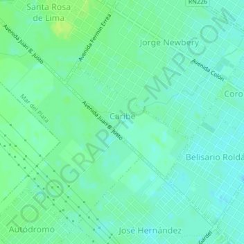
Name: Caribe topographic map, elevation, terrain.

Location: Caribe, Mar del Plata, Partido de General Pueyrredón, Buenos Aires, Argentina (-37.98572 -57.62922 -37.97321 -57.61161)

Average elevation: 89 ft

Minimum elevation: 69 ft

Maximum elevation: 112 ft

Other topographic maps

Click on a map to view its topography, its elevation and its terrain.
Gear up for your next adventure:

💧Water Filtration Bottles - Safely drink from streams and lakes while exploring
🏥Hiking First Aid Kits - Comprehensive medical kits for remote trail injuries
🪶Camping Sleeping Pad - Comfortable sleeping pad for backpacking
🧥Men's Rain Shells - Premium waterproof and breathable jackets for mountain weather
🧯Portable Fire Pit - Compact fire pit for camping spots

As an Amazon Associate, this site earns from qualifying purchases at no extra cost to you.