Geolocate

Fuente Plaza Rocha topographic map

Click on the map to display elevation.

About this map

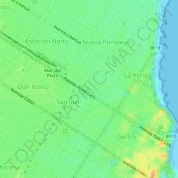
Name: Fuente Plaza Rocha topographic map, elevation, terrain.

Location: Fuente Plaza Rocha, Nueva Pompeya, Mar del Plata, Partido de General Pueyrredón, Buenos Aires, Argentina (-37.99234 -57.55760 -37.99215 -57.55736)

Average elevation: 49 ft

Minimum elevation: -7 ft

Maximum elevation: 128 ft

Other topographic maps

Click on a map to view its topography, its elevation and its terrain.

San Jacinto

Argentina > Buenos Aires > Mar del Plata

Average elevation: 62 ft

Caribe

Argentina > Buenos Aires > Mar del Plata

Average elevation: 89 ft

Regional

Argentina > Buenos Aires > Mar del Plata

Average elevation: 75 ft

Puerto

Argentina > Buenos Aires > Mar del Plata

Average elevation: 43 ft

Mar del Plata

Argentina > Buenos Aires > Mar del Plata

Average elevation: 66 ft

Gear up for your next adventure:

🎒Waterproof Dry Bags - Keep your electronics and maps dry inside your pack
🥤Water Filter Bottle - All‑in‑one filter bottle for safe hydration
🌎3D Topographic Globes - Raised relief globes for a tactile understanding of geography
😴Insulated Sleeping Pads - Compact and warm pads for high-elevation camping
📡Handheld GPS Device - Reliable handheld GPS for outdoor navigation

As an Amazon Associate, this site earns from qualifying purchases at no extra cost to you.