
Thank you for supporting this site ❤️
Make a donation
Make a donation
Gear up for your next adventure:
As an Amazon Associate, this site earns from qualifying purchases at no extra cost to you.
Reisach topographic map
Click on the map to display elevation.
Thank you for supporting this site ❤️
Make a donation
Make a donation
Gear up for your next adventure:
As an Amazon Associate, this site earns from qualifying purchases at no extra cost to you.
About this map
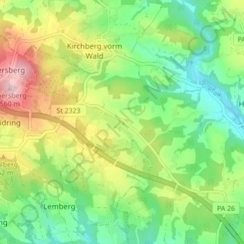
Name: Reisach topographic map, elevation, terrain.
Location: Reisach, Tiefenbach, Landkreis Passau, Bayern, Deutschland (48.61367 13.30939 48.65367 13.34939)
Average elevation: 1,342 ft
Minimum elevation: 1,037 ft
Maximum elevation: 1,847 ft
Thank you for supporting this site ❤️
Make a donation
Make a donation
Gear up for your next adventure:
As an Amazon Associate, this site earns from qualifying purchases at no extra cost to you.