Geolocate

Llanllowell topographic map

Click on the map to display elevation.

About this map

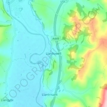
Name: Llanllowell topographic map, elevation, terrain.

Location: Llanllowell, Monmouthshire, Wales, NP15 1LJ, United Kingdom (51.66306 -2.90009 51.70306 -2.86009)

Average elevation: 171 ft

Minimum elevation: 23 ft

Maximum elevation: 696 ft

Gear up for your next adventure:

📚Navigation Handbooks - Master the art of reading topographic maps and using a compass
📌Outdoor GPS Map App - Apps and devices for digital topographic navigation
🧤Tactile Hiking Gloves - Keep hands warm while operating GPS and smartphone screens
🪑Portable Camp Table - Compact table for campsite meals
🚪Portable Camp Chair - Foldable chair for comfort at camp

As an Amazon Associate, this site earns from qualifying purchases at no extra cost to you.