Geolocate

Thompson topographic map

Click on the map to display elevation.

About this map

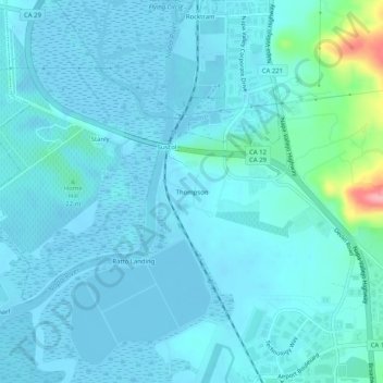
Name: Thompson topographic map, elevation, terrain.

Location: Thompson, Napa County, California, United States (38.21908 -122.30164 38.25908 -122.26164)

Average elevation: 43 ft

Minimum elevation: -23 ft

Maximum elevation: 400 ft

Napa County trails, hiking, mountain biking, running and outdoor activities

Gear up for your next adventure:

🌲Outdoor Survival Books - Best books on survival skills
🔦Powerful Headlamps - Ultra-bright hands-free lighting for night navigation
❄️Traction Cleats - Prevent slips on icy trails during winter hikes
🧭GPS Watch Accessories - Bands and chargers for GPS watches
🧭Hiking Compass - Precision compass for reliable navigation in the wilderness

As an Amazon Associate, this site earns from qualifying purchases at no extra cost to you.