Geolocate

Wallington topographic map

Click on the map to display elevation.

About this map

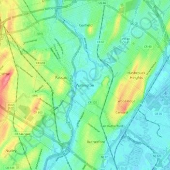
Name: Wallington topographic map, elevation, terrain.

Location: Wallington, Bergen County, New Jersey, 07057, United States (40.81316 -74.15375 40.89316 -74.07375)

Average elevation: 75 ft

Minimum elevation: -7 ft

Maximum elevation: 256 ft

Bergen County trails, hiking, mountain biking, running and outdoor activities

Gear up for your next adventure:

🪶Survival Guide Book - Expert advice for emergency preparedness
🔥Camping Stove - Portable stove for camping and backcountry cooking
🧦Merino Wool Socks - Moisture-wicking, blister-preventing socks for long treks
🦶Carbon Trekking Poles - Reduce knee impact on steep descents with ultra-light poles
🌲Outdoor Survival Books - Best books on survival skills

As an Amazon Associate, this site earns from qualifying purchases at no extra cost to you.