
Thank you for supporting this site ❤️
Make a donation
Make a donation
Gear up for your next adventure:
As an Amazon Associate, this site earns from qualifying purchases at no extra cost to you.
Welioya topographic map
Click on the map to display elevation.
Thank you for supporting this site ❤️
Make a donation
Make a donation
Gear up for your next adventure:
As an Amazon Associate, this site earns from qualifying purchases at no extra cost to you.
About this map
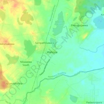
Name: Welioya topographic map, elevation, terrain.
Location: Welioya, Mullaitivu District, Northern Province, Sri Lanka (8.92743 80.74138 9.00743 80.82138)
Average elevation: 82 ft
Minimum elevation: 39 ft
Maximum elevation: 151 ft
Thank you for supporting this site ❤️
Make a donation
Make a donation
Gear up for your next adventure:
As an Amazon Associate, this site earns from qualifying purchases at no extra cost to you.