
Make a donation
Gear up for your next adventure:
As an Amazon Associate, this site earns from qualifying purchases at no extra cost to you.
Cape Coral topographic map
Click on the map to display elevation.
Make a donation
Gear up for your next adventure:
As an Amazon Associate, this site earns from qualifying purchases at no extra cost to you.
About this map
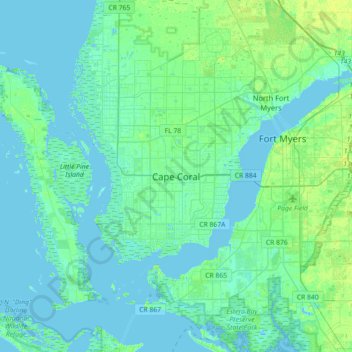
Name: Cape Coral topographic map, elevation, terrain.
Location: Cape Coral, Lee County, Florida, 33914-4648, United States (26.44594 -82.14068 26.76594 -81.82068)
Average elevation: 10 ft
Minimum elevation: -7 ft
Maximum elevation: 43 ft
Lee County trails, hiking, mountain biking, running and outdoor activities
Make a donation
Gear up for your next adventure:
As an Amazon Associate, this site earns from qualifying purchases at no extra cost to you.
Other topographic maps
Click on a map to view its topography, its elevation and its terrain.
Calusa Land Trust and Nature Preserve of Pine Island
United States > Florida > Lee County > Cape Coral
Average elevation: 3 ft