
Thank you for supporting this site ❤️
Make a donation
Make a donation
Gear up for your next adventure:
As an Amazon Associate, this site earns from qualifying purchases at no extra cost to you.
Ligao topographic map
Click on the map to display elevation.
Thank you for supporting this site ❤️
Make a donation
Make a donation
Gear up for your next adventure:
As an Amazon Associate, this site earns from qualifying purchases at no extra cost to you.
About this map
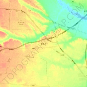
Name: Ligao topographic map, elevation, terrain.
Location: Ligao, Tunliu County, Changzhi City, Shanxi, China (36.21840 112.89500 36.29840 112.97500)
Average elevation: 3,058 ft
Minimum elevation: 2,956 ft
Maximum elevation: 3,136 ft
Thank you for supporting this site ❤️
Make a donation
Make a donation
Gear up for your next adventure:
As an Amazon Associate, this site earns from qualifying purchases at no extra cost to you.