Geolocate

Kayenta topographic map

Click on the map to display elevation.

About this map

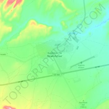
Name: Kayenta topographic map, elevation, terrain.

Location: Kayenta, Navajo County, Arizona, United States (36.68185 -110.29387 36.76185 -110.21387)

Average elevation: 5,748 ft

Minimum elevation: 5,459 ft

Maximum elevation: 6,496 ft

Gear up for your next adventure:

🗻Climbing Gear Basics - Essential gear for beginner climbers
🦶Hiking Gaiters - Keep debris and water out of your boots
🎒Outdoor Daypacks - Lightweight backpacks designed for carrying maps and essential gear
🔥Fast-Boil Camping Stoves - Efficient cooking systems for quick trail meals
🏫Relief Map Kits - Hands-on tools for teaching landforms and elevation

As an Amazon Associate, this site earns from qualifying purchases at no extra cost to you.