
Ícolo and Bengo Municipality topographic map
Interactive map
Click on the map to display elevation.
About this map
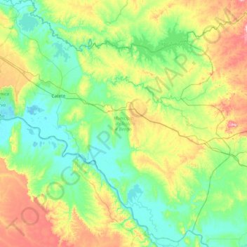
Name: Ícolo and Bengo Municipality topographic map, elevation, terrain.
Location: Ícolo and Bengo Municipality, Luanda Province, Angola (-9.54170 13.46532 -8.84204 14.20417)
Average elevation: 299 ft
Minimum elevation: -3 ft
Maximum elevation: 1,119 ft
Other topographic maps
Click on a map to view its topography, its elevation and its terrain.
Cabiri
Angola > Luanda Province > Ícolo and Bengo Municipality
Cabiri, Ícolo and Bengo Municipality, Luanda Province, Angola
Average elevation: 79 ft