
Make a donation
Gear up for your next adventure:
As an Amazon Associate, this site earns from qualifying purchases at no extra cost to you.
Grotte de Pech-Merle topographic map
Click on the map to display elevation.
Make a donation
Gear up for your next adventure:
As an Amazon Associate, this site earns from qualifying purchases at no extra cost to you.
Grotte de Pech-Merle
Le 15 février 1920, l'abbé Amédée Lemozi, curé de la paroisse, et des enfants - André David (fils du propriétaire de l'igue), Henri Dutertre, Louis Gineste et Henri Vinel - y font une première exploration mais ne découvrent que des ossements d'animaux contemporains (caprinés et bovinés). En avril 1922, André David et Henri Dutertre y retournent, dégagent à la pelle un boyau encombré d'argile et aboutissent dans la salle blanche. Averti par les enfants de cette dernière découverte, Amédée Lemozi et Pierre Colonge entreprennent une deuxième visite au cours de laquelle ils manquent de se perdre faute de moyens d'éclairage adéquats. L'abbé Lemozi interdit alors aux enfants de s'y aventurer. Le 4 septembre 1922, André David, sa sœur Marthe David et Henri Dutertre, après plusieurs heures d'exploration, découvrent les salles préhistoriques et en font part à Amédée Lemozi. Celui-ci y entreprend alors un relevé topographique complet, aidé d'André David.
Make a donation
Gear up for your next adventure:
As an Amazon Associate, this site earns from qualifying purchases at no extra cost to you.
About this map
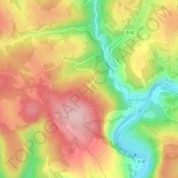
Name: Grotte de Pech-Merle topographic map, elevation, terrain.
Average elevation: 853 ft
Minimum elevation: 423 ft
Maximum elevation: 1,207 ft
Make a donation
Gear up for your next adventure:
As an Amazon Associate, this site earns from qualifying purchases at no extra cost to you.
Other topographic maps
Click on a map to view its topography, its elevation and its terrain.