Geolocate

Rabaul topographic map

Click on the map to display elevation.

About this map

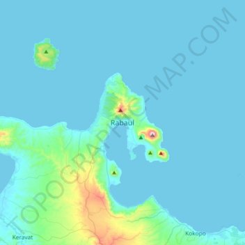
Name: Rabaul topographic map, elevation, terrain.

Location: Rabaul, East New Britain, Islands Region, Papua New Guinea (-4.35846 152.01283 -4.03846 152.33283)

Average elevation: 157 ft

Minimum elevation: 0 ft

Maximum elevation: 2,165 ft

Gear up for your next adventure:

🔦Powerful Headlamps - Ultra-bright hands-free lighting for night navigation
🦶Carbon Trekking Poles - Reduce knee impact on steep descents with ultra-light poles
🧢Sun Protection Hats - Wide-brimmed and UPF-rated hats for high-altitude sun safety
🏔️Mountain Trail Maps - High‑detail maps for popular peaks
🧭Outdoor Navigation Book - Learn advanced navigation skills

As an Amazon Associate, this site earns from qualifying purchases at no extra cost to you.