Geolocate

Silver Bay topographic map

Click on the map to display elevation.

About this map

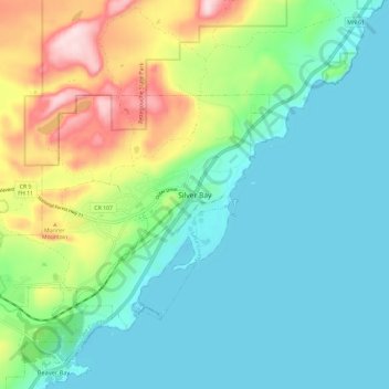
Name: Silver Bay topographic map, elevation, terrain.

Location: Silver Bay, Lake County, Minnesota, 55614, United States (47.25430 -91.29737 47.33430 -91.21737)

Average elevation: 840 ft

Minimum elevation: 577 ft

Maximum elevation: 1,555 ft

Gear up for your next adventure:

🪶Wildlife Field Guides - Learn animal tracking and species ID
🔊Portable Camp Speaker - Music and alerts at camp
🚑Emergency Bivvies - Heat-reflective sleeping bags for survival situations
👟Men's Trail Runners - Lightweight footwear for fast-paced exploration and light hiking
🏕️Tent Footprint - Protect your tent base from wear

As an Amazon Associate, this site earns from qualifying purchases at no extra cost to you.