
Ramachandrapuram mandal topographic map
Interactive map
Click on the map to display elevation.
About this map
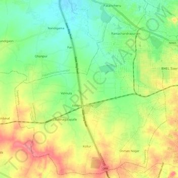
Name: Ramachandrapuram mandal topographic map, elevation, terrain.
Location: Ramachandrapuram mandal, Sangareddy, Telangana, 502032, India (17.42749 78.20639 17.52995 78.31781)
Average elevation: 1,824 ft
Minimum elevation: 1,713 ft
Maximum elevation: 1,972 ft
Other topographic maps
Click on a map to view its topography, its elevation and its terrain.
Velmula
India > Telangana > Ramachandrapuram mandal
Velmula, Ramachandrapuram mandal, Sangareddy, Telangana, India
Average elevation: 1,818 ft