
Clute topographic map
Click on the map to display elevation.
About this map
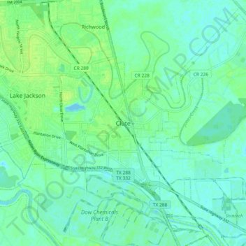
Name: Clute topographic map, elevation, terrain.
Location: Clute, Brazoria County, Texas, 77531, United States (28.98469 -95.43883 29.06469 -95.35883)
Average elevation: 16 ft
Minimum elevation: -7 ft
Maximum elevation: 36 ft
Brazoria County trails, hiking, mountain biking, running and outdoor activities