Geolocate

Eudora topographic map

Click on the map to display elevation.

About this map

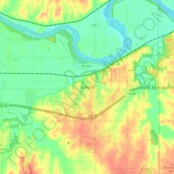
Name: Eudora topographic map, elevation, terrain.

Location: Eudora, Douglas County, Kansas, 66025, United States (38.90334 -95.13858 38.98334 -95.05858)

Average elevation: 846 ft

Minimum elevation: 774 ft

Maximum elevation: 928 ft

Douglas County trails, hiking, mountain biking, running and outdoor activities

Gear up for your next adventure:

🪑Portable Camp Table - Compact table for campsite meals
🎒Trekking Poles - Sturdy poles for balance and stability on rough terrain
🛰️Satellite Messengers - Emergency SOS and two-way messaging for off-grid adventures
🧭Outdoor Navigation Book - Learn advanced navigation skills
📚USA Hiking Guide Books - Top trail guides and map books

As an Amazon Associate, this site earns from qualifying purchases at no extra cost to you.