
Lafayette topographic map
Click on the map to display elevation.
Lafayette
Lafayette lies approximately 135 miles (217 km) from New Orleans, 59 miles (95 km) from the state capital of Baton Rouge, 75 miles (121 km) from Lake Charles, and 89 miles (143 km) from Alexandria. The city has an elevation ranging from 36 feet (11.0 m) to 49 feet (15 m) above sea level. According to the United States Census Bureau, the city has a total area of 55.65 square miles (144.1 km2), of which 55.57 square miles (143.9 km2) is land and 0.08 sq mi (0.21 km2) (0.19 percent) is covered by water.
About this map
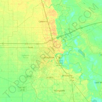
Name: Lafayette topographic map, elevation, terrain.
Location: Lafayette, Lafayette Parish, Louisiana, 70502, United States (30.04433 -92.18988 30.36433 -91.86988)
Average elevation: 30 ft
Minimum elevation: 0 ft
Maximum elevation: 69 ft
Lafayette Parish trails, hiking, mountain biking, running and outdoor activities