
Thank you for supporting this site ❤️
Make a donation
Make a donation
Gear up for your next adventure:
As an Amazon Associate, this site earns from qualifying purchases at no extra cost to you.
Bishorn topographic map
Click on the map to display elevation.
Thank you for supporting this site ❤️
Make a donation
Make a donation
Gear up for your next adventure:
As an Amazon Associate, this site earns from qualifying purchases at no extra cost to you.
About this map
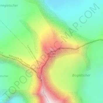
Name: Bishorn topographic map, elevation, terrain.
Location: Bishorn, Turtmann-Unterems, Loèche, Valais, 3948, Suisse (46.11787 7.71491 46.11797 7.71501)
Average elevation: 11,801 ft
Minimum elevation: 10,413 ft
Maximum elevation: 14,232 ft
Thank you for supporting this site ❤️
Make a donation
Make a donation
Gear up for your next adventure:
As an Amazon Associate, this site earns from qualifying purchases at no extra cost to you.