
Raccha Cedron topographic map
Click on the map to display elevation.
About this map
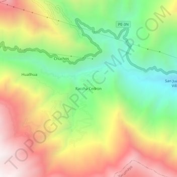
Name: Raccha Cedron topographic map, elevation, terrain.
Location: Raccha Cedron, Quisqui, Huánuco, Perú (-9.92154 -76.45611 -9.88154 -76.41611)
Average elevation: 10,669 ft
Minimum elevation: 8,609 ft
Maximum elevation: 13,054 ft