
Winagami Wildland Provincial Park topographic map
Interactive map
Click on the map to display elevation.
About this map
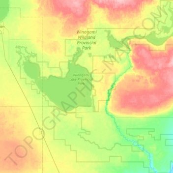
Name: Winagami Wildland Provincial Park topographic map, elevation, terrain.
Average elevation: 2,087 ft
Minimum elevation: 1,913 ft
Maximum elevation: 2,293 ft
Other topographic maps
Click on a map to view its topography, its elevation and its terrain.
Peavine Metis Settlement
Canada > Alberta > Big Lakes County
Peavine Metis Settlement, Big Lakes County, Alberta, Canada
Average elevation: 2,231 ft
Brush Mountain
Canada > Alberta > Big Lakes County
Brush Mountain, Big Lakes County, Alberta, Canada
Average elevation: 2,979 ft
Gift Lake
Canada > Alberta > Big Lakes County > Gift Lake
Gift Lake, Big Lakes County, Alberta, Canada
Average elevation: 2,182 ft
Joussard
Canada > Alberta > Big Lakes County > Joussard
Joussard, Big Lakes County, Alberta, Canada
Average elevation: 1,906 ft