
Make a donation
Gear up for your next adventure:
As an Amazon Associate, this site earns from qualifying purchases at no extra cost to you.
Olcani topographic map
Click on the map to display elevation.
Make a donation
Gear up for your next adventure:
As an Amazon Associate, this site earns from qualifying purchases at no extra cost to you.
Olcani
Au nord-est, se situe Bocca di San Giovanni un col remarquable à 957 m d'altitude, par où passe une piste ouverte en 1991. Très sinueuse, celle-ci permet depuis Olcani de rejoindre Sisco sur le versant oriental du Cap. Au col même se trouve la petite chapelle Saint-Jean. La vue sur les mers Méditerranée et Tyrrhénienne y est remarquable par bonne visibilité.
Make a donation
Gear up for your next adventure:
As an Amazon Associate, this site earns from qualifying purchases at no extra cost to you.
About this map
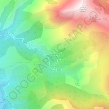
Name: Olcani topographic map, elevation, terrain.
Average elevation: 1,739 ft
Minimum elevation: 0 ft
Maximum elevation: 4,314 ft
Make a donation
Gear up for your next adventure:
As an Amazon Associate, this site earns from qualifying purchases at no extra cost to you.