Geolocate

Sinton topographic map

Click on the map to display elevation.

About this map

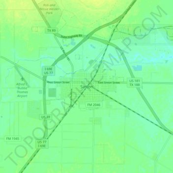
Name: Sinton topographic map, elevation, terrain.

Location: Sinton, San Patricio County, Texas, 78387, United States (27.99469 -97.54858 28.07469 -97.46858)

Average elevation: 59 ft

Minimum elevation: 36 ft

Maximum elevation: 82 ft

San Patricio County trails, hiking, mountain biking, running and outdoor activities

Gear up for your next adventure:

🔋Rechargeable Batteries - Power up your outdoor devices
🪄Magnetic Compass - Accurate compass for navigation
🛶Inflatable Kayak - Portable kayak for rivers, lakes, and expeditions
🧦Hiking Socks - Comfortable socks to prevent blisters on long hikes
📷Action Cameras - Rugged cameras to document your journeys across rugged terrain

As an Amazon Associate, this site earns from qualifying purchases at no extra cost to you.