Geolocate

Rainbow topographic map

Click on the map to display elevation.

About this map

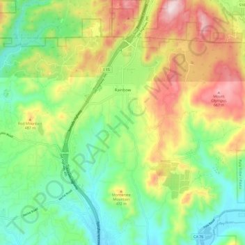
Name: Rainbow topographic map, elevation, terrain.

Location: Rainbow, San Diego County, California, United States (33.37229 -117.18004 33.43258 -117.09879)

Average elevation: 1,214 ft

Minimum elevation: 381 ft

Maximum elevation: 2,198 ft

San Diego County trails, hiking, mountain biking, running and outdoor activities

Gear up for your next adventure:

😴Insulated Sleeping Pads - Compact and warm pads for high-elevation camping
🪶Wildlife Field Guides - Learn animal tracking and species ID
🌧️Backpack Rain Cover - Keep gear dry in wet weather
🛰️Handheld GPS Units - Professional satellite navigators for precise backcountry mapping
Backpacking Tent - Lightweight and durable tent for multi‑day hikes

As an Amazon Associate, this site earns from qualifying purchases at no extra cost to you.