Geolocate

Union topographic map

Click on the map to display elevation.

About this map

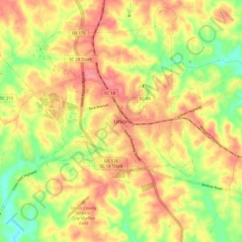
Name: Union topographic map, elevation, terrain.

Location: Union, Union County, South Carolina, 29379, United States (34.67519 -81.66375 34.75519 -81.58375)

Average elevation: 561 ft

Minimum elevation: 404 ft

Maximum elevation: 679 ft

Union County trails, hiking, mountain biking, running and outdoor activities

Gear up for your next adventure:

🛶Inflatable Kayak - Portable kayak for rivers, lakes, and expeditions
🚗GPS Dash Cams - Record your scenic drives through mountain passes and canyons
🛡️Insect Repellent - Protection against bugs during outdoor activities
🧭Outdoor Navigation Book - Learn advanced navigation skills
🪶Paracord Bracelet - Survival bracelet with built‑in tools

As an Amazon Associate, this site earns from qualifying purchases at no extra cost to you.