Geolocate

Gerry topographic map

Click on the map to display elevation.

About this map

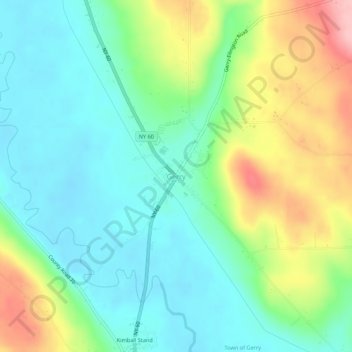
Name: Gerry topographic map, elevation, terrain.

Location: Gerry, Chautauqua County, New York, 14740, United States (42.17339 -79.26866 42.21339 -79.22866)

Average elevation: 1,404 ft

Minimum elevation: 1,237 ft

Maximum elevation: 1,752 ft

Chautauqua County trails, hiking, mountain biking, running and outdoor activities

Gear up for your next adventure:

🛌Ultralight Sleeping Bags - Compact down bags for cold nights in the wilderness
🔥Camping Stove - Portable stove for camping and backcountry cooking
🪶Compact Camp Shovel - Folding shovel for campsite tasks
🪶Trail Camera - Capture wildlife on your hikes
🔭Stargazing Telescopes - Perfect for camping in low-light pollution areas shown on maps

As an Amazon Associate, this site earns from qualifying purchases at no extra cost to you.