
Thank you for supporting this site ❤️
Make a donation
Make a donation
Gear up for your next adventure:
As an Amazon Associate, this site earns from qualifying purchases at no extra cost to you.
Fredrika topographic map
Click on the map to display elevation.
Thank you for supporting this site ❤️
Make a donation
Make a donation
Gear up for your next adventure:
As an Amazon Associate, this site earns from qualifying purchases at no extra cost to you.
About this map
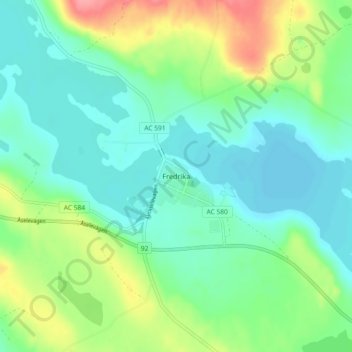
Name: Fredrika topographic map, elevation, terrain.
Location: Fredrika, Åsele kommun, Västerbotten County, 91993, Sweden (64.05730 18.38488 64.09730 18.42488)
Average elevation: 1,004 ft
Minimum elevation: 925 ft
Maximum elevation: 1,194 ft
Thank you for supporting this site ❤️
Make a donation
Make a donation
Gear up for your next adventure:
As an Amazon Associate, this site earns from qualifying purchases at no extra cost to you.