
Thank you for supporting this site ❤️
Make a donation
Make a donation
Gear up for your next adventure:
As an Amazon Associate, this site earns from qualifying purchases at no extra cost to you.
Gdyel topographic map
Click on the map to display elevation.
Thank you for supporting this site ❤️
Make a donation
Make a donation
Gear up for your next adventure:
As an Amazon Associate, this site earns from qualifying purchases at no extra cost to you.
About this map
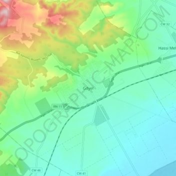
Name: Gdyel topographic map, elevation, terrain.
Location: Gdyel, Daïra Gdyel, Oran, 31260, Algérie (35.74249 -0.46420 35.82249 -0.38420)
Average elevation: 577 ft
Minimum elevation: 259 ft
Maximum elevation: 1,473 ft
Thank you for supporting this site ❤️
Make a donation
Make a donation
Gear up for your next adventure:
As an Amazon Associate, this site earns from qualifying purchases at no extra cost to you.