Geolocate

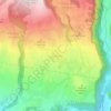
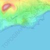
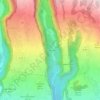
Langevin topographic map

Click on the map to display elevation.

About this map

Name: Langevin topographic map, elevation, terrain.

Location: Langevin, Saint-Joseph, Saint-Pierre, La Réunion, 97480, France (-21.38787 55.64363 -21.37490 55.65512)

Average elevation: 223 ft

Minimum elevation: 0 ft

Maximum elevation: 932 ft

Other topographic maps

Click on a map to view its topography, its elevation and its terrain.
Jean-Petit

France > La Réunion > Saint-Joseph

Average elevation: 1,585 ft

Les Lianes

France > La Réunion > Saint-Joseph

Average elevation: 1,526 ft

Bois-Noir

France > La Réunion > Saint-Joseph

Average elevation: 295 ft

Parc à Mouton

France > La Réunion > Saint-Joseph

Average elevation: 860 ft

Grand Coude

France > La Réunion > Saint-Joseph

Average elevation: 2,920 ft

Plaine des Grègues

France > La Réunion > Saint-Joseph

Average elevation: 2,129 ft

Le Butor

France > La Réunion > Saint-Joseph

Average elevation: 210 ft

Cale de Langevin

France > La Réunion > Saint-Joseph

Average elevation: 102 ft

Piton de Carosse

France > La Réunion > Saint-Joseph

Average elevation: 722 ft

Roche Plate

France > La Réunion > Saint-Joseph

Average elevation: 4,180 ft

Les Grègues

France > La Réunion > Saint-Joseph

Average elevation: 312 ft

Badera

France > La Réunion > Saint-Joseph

Average elevation: 476 ft

Terre Rouge

France > La Réunion > Saint-Joseph

Average elevation: 177 ft

Jean-Petit les Bas

France > La Réunion > Saint-Joseph

Average elevation: 748 ft

la Petite Crête

France > La Réunion > Saint-Joseph

Average elevation: 1,204 ft

La Cayenne

France > La Réunion > Saint-Joseph

Average elevation: 128 ft

Les Quais

France > La Réunion > Saint-Joseph

Average elevation: 177 ft

Pointe du Coteau

France > La Réunion > Saint-Joseph

Average elevation: 3,402 ft

Cap Blanc

France > La Réunion > Saint-Joseph

Average elevation: 3,858 ft

Le Butor

France > La Réunion > Saint-Joseph

Average elevation: 210 ft

Les Quais

France > La Réunion > Saint-Joseph

Average elevation: 177 ft

Jean-Petit les Bas

France > La Réunion > Saint-Joseph

Average elevation: 748 ft

Les Lianes

France > La Réunion > Saint-Joseph

Average elevation: 1,526 ft

Les Lianes

France > La Réunion > Saint-Joseph

Average elevation: 1,526 ft

la Petite Crête

France > La Réunion > Saint-Joseph

Average elevation: 1,204 ft

Ilet à Diable

France > La Réunion > Saint-Joseph

Average elevation: 1,371 ft

Plaine des Grègues

France > La Réunion > Saint-Joseph

Average elevation: 2,129 ft

Plaine des Grègues

France > La Réunion > Saint-Joseph

Average elevation: 2,129 ft

Gear up for your next adventure:

🔥Camping Stove - Portable stove for camping and backcountry cooking
📻Weather Alert Radios - Stay informed of storm risks while off-the-grid
🖼️Topo Map Wall Art - Decorative topographic prints of famous peaks and regions
🛰️Handheld GPS Units - Professional satellite navigators for precise backcountry mapping
🧷Carabiner Set - Durable clips for gear attachment

As an Amazon Associate, this site earns from qualifying purchases at no extra cost to you.