Geolocate

Saur topographic map

Click on the map to display elevation.

About this map

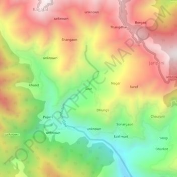
Name: Saur topographic map, elevation, terrain.

Location: Saur, Tehri, Tehri Garhwal, Uttarakhand, India (30.37744 78.31387 30.41744 78.35387)

Average elevation: 6,214 ft

Minimum elevation: 4,413 ft

Maximum elevation: 8,005 ft

Gear up for your next adventure:

🧯Portable Fire Pit - Compact fire pit for camping spots
🛡️Bear Spray Outdoor - Protection in bear country hikes
🪶Fire Starter Kit - Reliable fire starter for survival and camping
🔦LED Headlamp - Bright and durable LED headlamp for night navigation
🪶Compact Camp Shovel - Folding shovel for campsite tasks

As an Amazon Associate, this site earns from qualifying purchases at no extra cost to you.