Geolocate

Muchac topographic map

Click on the map to display elevation.

About this map

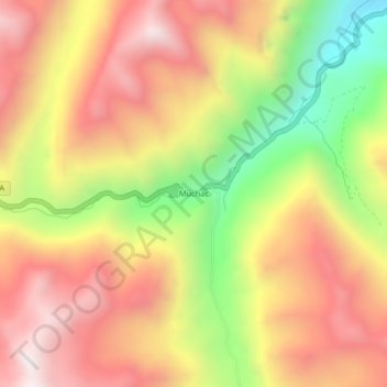
Name: Muchac topographic map, elevation, terrain.

Location: Muchac, Comas, Provincia de Concepción, Junín, Perú (-11.78976 -75.17217 -11.74976 -75.13217)

Average elevation: 13,875 ft

Minimum elevation: 11,890 ft

Maximum elevation: 15,390 ft

Gear up for your next adventure:

🌄Hiking Binoculars - Compact binoculars for scenic views and trail spotting
🥇GPS Hiking Watch - Multi‑sport GPS watch with navigation and trail tracking
🪶Multi‑Purpose Knife - Useful blade for camp and trail
🪶Camping Sleeping Pad - Comfortable sleeping pad for backpacking
📖Nature Tracking Books - Learn to track wildlife and terrain

As an Amazon Associate, this site earns from qualifying purchases at no extra cost to you.