Geolocate

Mount Royal topographic map

Click on the map to display elevation.

About this map

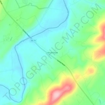
Name: Mount Royal topographic map, elevation, terrain.

Location: Mount Royal, Dover Township, York County, Pennsylvania, 17358, United States (40.01926 -76.90775 40.05926 -76.86775)

Average elevation: 509 ft

Minimum elevation: 338 ft

Maximum elevation: 945 ft

Other topographic maps

Click on a map to view its topography, its elevation and its terrain.

Gear up for your next adventure:

🧥Waterproof Jacket for Hiking - Breathable and rugged rain jacket for outdoor excursions
😴Insulated Sleeping Pads - Compact and warm pads for high-elevation camping
🧢Outdoor Hiking Hat - Sun protection hat for outdoor explorers
🕶️GPS Smartphone Mount - Secure mount for phone navigation
📻Weather Alert Radios - Stay informed of storm risks while off-the-grid

As an Amazon Associate, this site earns from qualifying purchases at no extra cost to you.