
Thank you for supporting this site ❤️
Make a donation
Make a donation
Gear up for your next adventure:
As an Amazon Associate, this site earns from qualifying purchases at no extra cost to you.
Chanca topographic map
Click on the map to display elevation.
Thank you for supporting this site ❤️
Make a donation
Make a donation
Gear up for your next adventure:
As an Amazon Associate, this site earns from qualifying purchases at no extra cost to you.
About this map
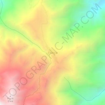
Name: Chanca topographic map, elevation, terrain.
Location: Chanca, Mecapaca, Pedro Domingo Murillo, La Paz, Bolivia (-16.78429 -68.00073 -16.74429 -67.96073)
Average elevation: 11,667 ft
Minimum elevation: 9,186 ft
Maximum elevation: 14,094 ft
Thank you for supporting this site ❤️
Make a donation
Make a donation
Gear up for your next adventure:
As an Amazon Associate, this site earns from qualifying purchases at no extra cost to you.