Geolocate

Waghai topographic map

Click on the map to display elevation.

About this map

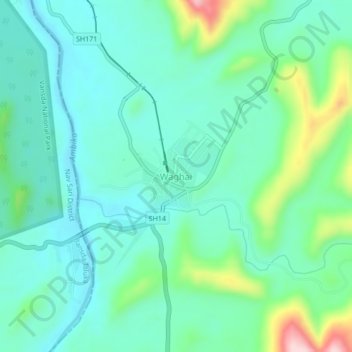
Name: Waghai topographic map, elevation, terrain.

Location: Waghai, Vaghai Taluka, The Dangs, Gujarat, 394730, India (20.75104 73.48165 20.79104 73.52165)

Average elevation: 528 ft

Minimum elevation: 328 ft

Maximum elevation: 1,194 ft

Gear up for your next adventure:

🧭GPS Watch Accessories - Bands and chargers for GPS watches
⛑️Personal Locator Beacon - Safety beacon for emergencies
📌Outdoor GPS Map App - Apps and devices for digital topographic navigation
📡Handheld GPS Device - Reliable handheld GPS for outdoor navigation
🥘Titanium Cookware - Durable, featherlight pots and pans for backpacking

As an Amazon Associate, this site earns from qualifying purchases at no extra cost to you.