
Thank you for supporting this site ❤️
Make a donation
Make a donation
Gear up for your next adventure:
As an Amazon Associate, this site earns from qualifying purchases at no extra cost to you.
Rasillo topographic map
Click on the map to display elevation.
Thank you for supporting this site ❤️
Make a donation
Make a donation
Gear up for your next adventure:
As an Amazon Associate, this site earns from qualifying purchases at no extra cost to you.
About this map
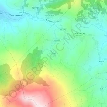
Name: Rasillo topographic map, elevation, terrain.
Location: Rasillo, Villafufre, Valles Pasiegos, Cantabria, 39638, España (43.23216 -3.91069 43.27216 -3.87069)
Average elevation: 1,175 ft
Minimum elevation: 400 ft
Maximum elevation: 2,730 ft
Thank you for supporting this site ❤️
Make a donation
Make a donation
Gear up for your next adventure:
As an Amazon Associate, this site earns from qualifying purchases at no extra cost to you.