
Make a donation
Gear up for your next adventure:
As an Amazon Associate, this site earns from qualifying purchases at no extra cost to you.
Manchester topographic map
Click on the map to display elevation.
Make a donation
Gear up for your next adventure:
As an Amazon Associate, this site earns from qualifying purchases at no extra cost to you.
Manchester
Manchester is in west central Georgia, in southern Meriwether County, with a small portion extending south into Talbot County. The ridge of Pine Mountain runs along the southern edge of the city, rising 300 feet (91 m) above the city to an elevation of 1,180 feet (360 m) above sea level. Georgia State Route 85 is the main highway through the city, leading southwest 39 miles (63 km) to Columbus and north 10 miles (16 km) to Woodbury. Georgia 85 meets Georgia 190 in the southern part of the city, which leads west 16 miles (26 km) along the crest of Pine Mountain to U.S. Route 27 south of the town of Pine Mountain. Georgia 85 meets Georgia 41 in the center of Manchester, which leads southeast 6 miles (10 km) to Woodland and northwest 5 miles (8 km) to Warm Springs.
Make a donation
Gear up for your next adventure:
As an Amazon Associate, this site earns from qualifying purchases at no extra cost to you.
About this map
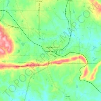
Name: Manchester topographic map, elevation, terrain.
Location: Manchester, Meriwether County, Georgia, United States (32.84027 -84.69766 32.87350 -84.58857)
Average elevation: 869 ft
Minimum elevation: 696 ft
Maximum elevation: 1,230 ft
Meriwether County trails, hiking, mountain biking, running and outdoor activities
Make a donation
Gear up for your next adventure:
As an Amazon Associate, this site earns from qualifying purchases at no extra cost to you.