Geolocate

Patía topographic map

Click on the map to display elevation.

About this map

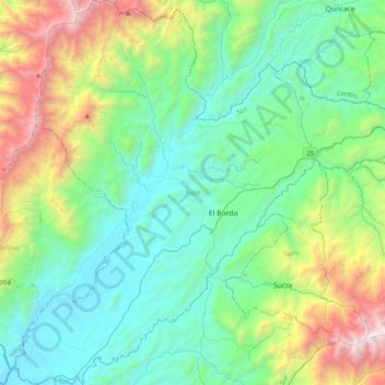
Name: Patía topographic map, elevation, terrain.

Location: Patía, Sur del Cauca, Cauca, RAP Pacífico, Colombia (1.93611 -77.20149 2.32953 -76.89172)

Average elevation: 4,088 ft

Minimum elevation: 1,798 ft

Maximum elevation: 11,352 ft

Gear up for your next adventure:

🎒Waterproof Dry Bags - Keep your electronics and maps dry inside your pack
🪵Folding Camp Saw - Compact saw for wood and campsite work
🌲Outdoor Survival Books - Best books on survival skills
🗺️NatGeo Topo Maps - High-quality waterproof printed topographic maps of US Parks
🧦Merino Wool Socks - Moisture-wicking, blister-preventing socks for long treks

As an Amazon Associate, this site earns from qualifying purchases at no extra cost to you.