
Thank you for supporting this site ❤️
Make a donation
Make a donation
Gear up for your next adventure:
As an Amazon Associate, this site earns from qualifying purchases at no extra cost to you.
Ulucak topographic map
Click on the map to display elevation.
Thank you for supporting this site ❤️
Make a donation
Make a donation
Gear up for your next adventure:
As an Amazon Associate, this site earns from qualifying purchases at no extra cost to you.
About this map
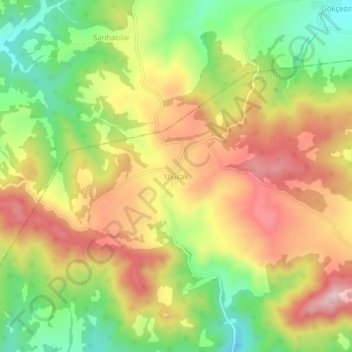
Name: Ulucak topographic map, elevation, terrain.
Location: Ulucak, Yenipazar, Bilecik, Marmara Region, Turkey (40.24936 30.50618 40.28936 30.54618)
Average elevation: 3,297 ft
Minimum elevation: 2,720 ft
Maximum elevation: 3,871 ft
Thank you for supporting this site ❤️
Make a donation
Make a donation
Gear up for your next adventure:
As an Amazon Associate, this site earns from qualifying purchases at no extra cost to you.