
Thank you for supporting this site ❤️
Make a donation
Make a donation
Gear up for your next adventure:
As an Amazon Associate, this site earns from qualifying purchases at no extra cost to you.
Palaiseau topographic map
Click on the map to display elevation.
Thank you for supporting this site ❤️
Make a donation
Make a donation
Gear up for your next adventure:
As an Amazon Associate, this site earns from qualifying purchases at no extra cost to you.
About this map
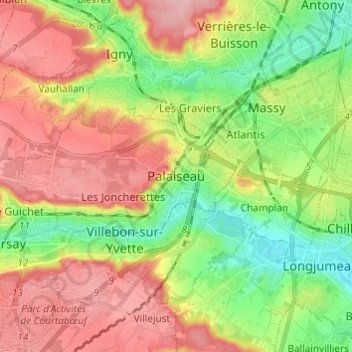
Name: Palaiseau topographic map, elevation, terrain.
Location: Palaiseau, Essonne, France métropolitaine, 91120, France (48.67446 2.20538 48.75446 2.28538)
Average elevation: 341 ft
Minimum elevation: 135 ft
Maximum elevation: 568 ft
Thank you for supporting this site ❤️
Make a donation
Make a donation
Gear up for your next adventure:
As an Amazon Associate, this site earns from qualifying purchases at no extra cost to you.