Geolocate

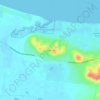
Susan River topographic map

Click on the map to display elevation.

About this map

Name: Susan River topographic map, elevation, terrain.

Location: Susan River, Hervey Bay, Queensland, Australia (-25.45886 152.73267 -25.36609 152.92104)

Average elevation: 46 ft

Minimum elevation: -10 ft

Maximum elevation: 285 ft

Other topographic maps

Click on a map to view its topography, its elevation and its terrain.
Craignish

Australia > Queensland > Hervey Bay

Average elevation: 26 ft

Big Woody Island

Australia > Queensland > Hervey Bay

Average elevation: 10 ft

Dayman Park

Australia > Queensland > Hervey Bay

Average elevation: 10 ft

Booral

Australia > Queensland > Hervey Bay

Average elevation: 89 ft

Gear up for your next adventure:

🧤Hiking Gloves - Protective gloves for rugged trails
🥾Women's Hiking Boots - Top-rated trail boots with ankle support and superior grip
🎒Hydration Pack - Hands‑free water reservoir for long hikes
🧼Biodegradable Camping Soap - Eco‑friendly soap for outdoor hygiene
🪶Thermal Camp Blanket - Extra warmth for cold nights

As an Amazon Associate, this site earns from qualifying purchases at no extra cost to you.