

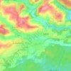
Krottelbach topographic map
Click on the map to display elevation.
Krottelbach
The municipality lies in the Western Palatinate near the state boundary with the Saarland. Krottelbach lies on the upper reaches of its namesake brook, the Krottelbach, which rises in the woods west of the village. Several tributary brooks flow from side valleys, forming a radial pattern and emptying into the Krottelbach within the municipality. Almost all these surrounding side valleys are settled, giving the village a somewhat star-shaped built-up area. The lowest houses in Krottelbach stand roughly 270 m above sea level, whereas higher locations reach 280 m. The valley slopes are steep, and in the west reach an elevation of 445 m above sea level at the Kaiserberg. This wooded area with the Hoher Fels (“High Crag”) and the hiker's cabin belonging to the Pfälzerwaldverein (a hiking club) is said to be a popular hiking area. The municipal area measures 555 ha, of which 161 ha is wooded.
About this map

Name: Krottelbach topographic map, elevation, terrain.
Average elevation: 1,079 ft
Minimum elevation: 833 ft
Maximum elevation: 1,522 ft
Other topographic maps
Click on a map to view its topography, its elevation and its terrain.
Schönenberg
Germany > Rhineland-Palatinate > Landkreis Kusel > Schönenberg-Kübelberg
Average elevation: 873 ft