Geolocate

Finzel topographic map

Click on the map to display elevation.

About this map

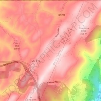
Name: Finzel topographic map, elevation, terrain.

Location: Finzel, Garrett County, Maryland, United States (39.66578 -78.97045 39.72278 -78.92843)

Average elevation: 2,552 ft

Minimum elevation: 1,611 ft

Maximum elevation: 2,917 ft

Garrett County trails, hiking, mountain biking, running and outdoor activities

Gear up for your next adventure:

👓Polarized Sunglasses - Outdoor sunglasses for glare reduction
🖼️Topo Map Wall Art - Decorative topographic prints of famous peaks and regions
🏫Relief Map Kits - Hands-on tools for teaching landforms and elevation
📡GPS Antenna Upgrade - Enhance GPS reception in remote terrain
📦Gear Storage Bags - Organize and protect outdoor equipment

As an Amazon Associate, this site earns from qualifying purchases at no extra cost to you.