Geolocate

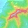
Vajragad topographic map

Click on the map to display elevation.

About this map

Name: Vajragad topographic map, elevation, terrain.

Location: Vajragad, Narayanpur, Purandhar, Pune District, Maharashtra, 412102, India (18.28433 73.98909 18.28443 73.98919)

Average elevation: 3,409 ft

Minimum elevation: 2,861 ft

Maximum elevation: 4,429 ft

Other topographic maps

Click on a map to view its topography, its elevation and its terrain.
Purandar Fort

India > Maharashtra > Purandhar > Narayanpur

Average elevation: 3,369 ft

Purandar Fort

India > Maharashtra > Purandhar > Narayanpur

Average elevation: 3,369 ft

Gear up for your next adventure:

🧦Hiking Socks - Comfortable socks to prevent blisters on long hikes
📚USA Hiking Guide Books - Top trail guides and map books
🛡️Insect Repellent - Protection against bugs during outdoor activities
🔦LED Headlamp - Bright and durable LED headlamp for night navigation
☀️Outdoor Sunscreen - High protection sunscreen for outdoor activities

As an Amazon Associate, this site earns from qualifying purchases at no extra cost to you.