
Thank you for supporting this site ❤️
Make a donation
Make a donation
Gear up for your next adventure:
As an Amazon Associate, this site earns from qualifying purchases at no extra cost to you.
Urán topographic map
Click on the map to display elevation.
Thank you for supporting this site ❤️
Make a donation
Make a donation
Gear up for your next adventure:
As an Amazon Associate, this site earns from qualifying purchases at no extra cost to you.
About this map
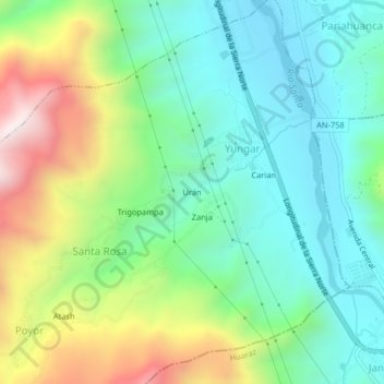
Name: Urán topographic map, elevation, terrain.
Location: Urán, Santa Rosa, Yungar, Carhuaz, Ancash, 02120, Peru (-9.40238 -77.61760 -9.36238 -77.57760)
Average elevation: 9,938 ft
Minimum elevation: 8,990 ft
Maximum elevation: 11,949 ft
Thank you for supporting this site ❤️
Make a donation
Make a donation
Gear up for your next adventure:
As an Amazon Associate, this site earns from qualifying purchases at no extra cost to you.